There are about 1,867 miles of hiking trails in the Peak District, with countless spectacular routes. They range from simple paved walks that you can cover in less than 1 hour to multi-day, rough-terrain endurance challenges. One thing they all have in common, however, is that they'll each expose you to the region’s amazing scenery and fresh country air.
We’ve picked out some of the best hiking trails in the Peak District, but our selection is far from comprehensive. While we’ve perhaps had to cut out some excellent routes, we've assembled a representative sample of what the area has to offer, ranging from the family-friendly to the extremely challenging.
What are the best hiking trails in the Peak District?
- 1
Edale Walk
A challenging hike up Mam Tor

- Abenteuer
- Budget
- Foto
The Edale Walk is a circular route that visits Mam Tor, one of the main highlights of the Peak District. It’s a challenging 7.5-mile hike, but the views you’ll get along the way make it well worth the effort.
The route starts out following the Pennine Way from Edale and crosses the valley to Mam Tor. You then join farm tracks to Upper Booth – that’s the easy bit. Next, you climb Rushup Edge and follow the ridge to the summit of Mam Tor. You keep going along the iconic Grand Ridge to Hollins Cross before heading back to Edale.
Karte - 2
Pennine Way
Follow the mountainous spine of England

- Abenteuer
- Budget
- Foto
The Pennine Way is one of the longest, oldest and most challenging trails in the UK. Opened in 1965, it starts at Edale in the Derbyshire Peak District and goes north for 268 miles through the Yorkshire Dales and Northumberland National Park. It then finally ends at Kirk Yetholm in the Scottish Borders, following the Pennines up the spine of England.
The part of the trail that passes through the Peak District hits some of the national park’s highlights, including its highest peak, Kinder Scout. Further on, it climbs Bleaklow before descending to Longdendale, crossing the dam at Torside Reservoir and finally to Crowden. That’s 16 miles from the starting village to the next settlement. From Crowden, the trail continues to the summit of Black Hill before dropping into the Wessenden Valley in Yorkshire and out of the Peaks.
Karte - 3
Hathersage and Stanage Edge
Follow in the footsteps of Jane Eyre

- Abenteuer
- Budget
- Paare
- Foto
The Hathersage and Stanage Edge hike follows in the footsteps of the Brontë sisters along some impressively picturesque Derbyshire countryside. The trail is moderately difficult and runs for about 5.8 miles, so should take you about 3.5 hours.
Head north along the path out of the small town of Hathersage along with Stanage Edge on your right. The track gets a little rough as you veer more towards the sheer rock wall, but the singing skylarks will keep you company. Once you look around and start heading back to Hathersage, you’ll follow Hood Brook for a while, passing scenes that inspired settings of Jane Eyre.
Karte - 4
The Limestone Way
Hike through a fascinated eroded landscape

- Abenteuer
- Budget
- Foto
The Limestone Way is a long-distance trail in Derbyshire that goes for 46 miles, eventually joining up with the Staffordshire Way. As the name suggests, it’s famous for the limestone scenery you’ll find along the way, though it also passes by some highlights of the Peak District.
The route starts from the village of Castleton, heading south by Peveril Castle, Cave Dale, through the village of Peak Forest, down Hay Dale, and along Peter Dale. From there, you go through Millers Dale, crossing the A6 before following old miners’ tracks through Flagg and Monyash. You follow the River Bradford for a bit, cross Harthill Moor and follow the ancient Portway track past Elton, Winster and Bonsall. This finally takes you out of the Peak District National Park, but the path continues along an interesting route to Rochester in Staffordshire.
Karte - 5
Robin Hood’s Stride Walk
A family-friendly hiking trail in the Peak District

- Abenteuer
- Budget
- Familien
- Foto
The Robin Hood’s Stride Walk was specifically developed for children and families. The 2.7-mile route passes climbable trees and rocks, a hermit’s cave and a rope swing. And, of course, there’s stunning Peak District scenery along the way.
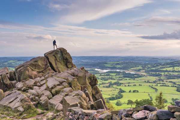
The route starts and ends in Elton and heads up to the precariously balanced gritstone rocks at Robin Hood’s Stride. The rock formation is also one of the stops along the Limestone Way, but this particular walk is a lot shorter and easier.
Karte - 6
Minninglow Walk
Explore an ancient hilltop burial ground

- Abenteuer
- Budget
- Geschichte
- Foto
The Minninglow Walk is a short and easy hiking trail in the Peak District that stops atop Minninglow Hill. It’s a fascinating historical destination, featuring Neolithic tombs dating back to around 3,000 BC. There are also burial mounds from the Bronze Age. You'll be able to take in excellent views along the whole walk.
The 3-mile trail starts off on the High Peak Trail from Minninglow Car Park, heading east and passing a high embankment and past a disused quarry. Soon after you pass the rusted old quarry crane, turn left onto the track going up the hill. After exploring the history of the area, leave in another direction to complete a circular hike along country lanes.
Karte - 7
Monsal Trail
Cycle along an old railway line between Buxton and Bakewell

- Abenteuer
- Budget
- Familien
- Geschichte
- Foto
The Monsal Trail is a well-known route for cycling and walking that starts east of Buxton and runs to Bakewell, following part of the old Manchester – London railway. As the 8.5-mile trail follows the old rail tracks and has been paved for cyclists, it’s a very easy journey. You’ll see some interesting feats of Victorian-era engineering along the way.
Starting the route from near Bakewell helps you avoid the crowds and you can choose to cut the trail down to a shorter route. You’ll see the impressive Coombs Viaduct, Hassop Station (which has been converted into a rather good café), Headstone Viaduct and pass through the tunnel at Cressbrook, as well as crossing over the River Wye several times.
Karte - 8
Wyming Brook Walk
Explore a beautiful nature reserve on a pleasant woodland walk

- Abenteuer
- Budget
- Foto
The Wyming Brook Walk takes you through a beautiful area that used to be a private hunting forest. Now a combination of nature reserves and Sites of Special Scientific Interest, it’s changed into a safe haven for wildlife. The birdlife is especially vibrant, with crossbills, dippers, wood warblers and redstarts calling the woods home.
The 1.7-mile hike is quite an easy one, with only uneven woodland trails to challenge you. You start near the Redmires Reservoirs, follow the brook north towards the Rivelin Dams and then circle back around to your start point. You could extend the walk by heading around the Rivelin Reservoir.
Karte - 9
Dovedale Walk
Follow the River Dove up its beautiful valley

- Abenteuer
- Budget
- Paare
- Familien
- Foto
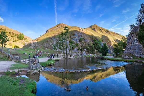
The beautiful Dovedale Valley offers a couple of great hiking trails, ranging in length and difficulty from an easy 6 miles to a moderate 7.2 miles and beyond. Highlights along the way include the Dovedale Stepping Stones on the River Dove, Reynards Cave and potentially even Ilam Park. Note that the Stepping Stones are a favourite for families, but are only open from Easter to October.
It’s a good idea to start your walks from the Dovedale Car Park, if only because there’s plenty of space to park there. Head north along the River Dove, following the valley and you’ll pass all of the highlights as you head towards the villages of Alstonefield and Hope. You can then turn back and return to your car via Stanshope and Ilam.
Karte - 10
Padley Gorge Trail
See the old millstones under the ancient beech trees

- Abenteuer
- Budget
- Geschichte
- Foto
Padley Gorge is a charming wooded glen that follows the Burbage Brook between Grindleford and the area of the Longshaw Estate. The trail itself is only about 1.4 miles long, but you can turn the walk into a loop by adding a visit to Longshaw.
An interesting feature of Padley Gorge is the sight of old millstones gradually being reclaimed by nature. The area used to be an important source of millstones for use in corn mills and even in Sheffield’s cutlery industry. Better alternatives were found in the early 20th century, leaving dozens of complete and semi-complete millstones with nothing to do but provide a curiosity for passing ramblers.
Karte


